
TONIGHT
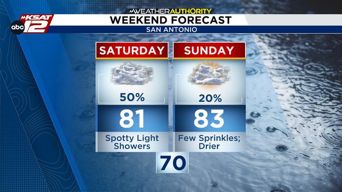
Rain showers this evening are staying south of I-10 and east I-37. Rain activity will continue to die down as we head into the overnight hours. It’s possible to see additional shower activity developing in the early Sunday morning hours for areas west of San Antonio and the Hill Country. These will consist of light shower activity.
RAIN STARTS WINDING DOWN

The transition toward drier weather begins Sunday as the best rain chances gradually shift south of the area. A few showers or isolated thunderstorms will still be possible early Sunday afternoon, but rain coverage should decrease as the day progresses. Then comes the change many of us have been waiting for!

FINALLY FEELING LIKE FALL
So, after a soggy end to the week and some additional rain this weekend, the overall trend is encouraging: lower humidity, more sunshine and pleasant early-October weather are expected next week. By Monday, northerly flow will begin ushering drier, less humid air into South Central Texas.

Temperatures should remain comfortable for early October, with most locations seeing afternoon highs in the lower to middle 80s. There is some uncertainty towards the end of next week as rain chances creep in due to the development of a low pressure disturbance over Texas. We’ll closely watch how this develops and whether rain chances could increase.


